
Our Guidebook - Hiking and Trails
Hiking
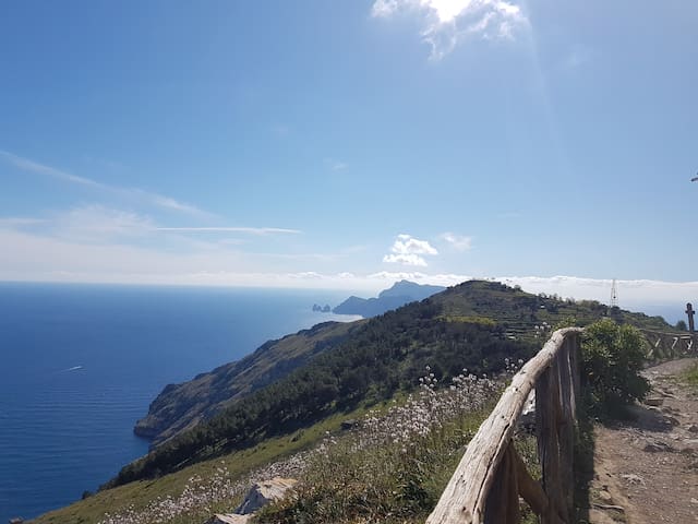
The Path of the Gods is one of the most beautiful nature trails in the world. Located within the Amalfi Coast, the path starts from Agerola and ends in the upper part of Positano, in the small hilly village of Nocelle, and measures a length of about 10 km (round trip). Along the entire path it is possible to find breathtaking panoramic terraces where you can admire the Faraglioni rocks of the island of Capri, the Li Galli island and the Milkey Mountains, comfortable wooden benches and tables where you can have a picnic and rest to recharge your batteries.
90 personas del lugar lo recomiendan
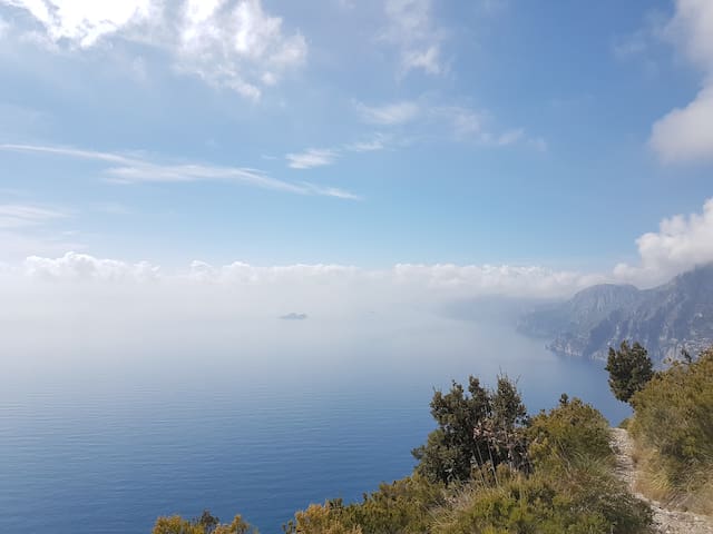
Path of Gods
Sentiero degli DeiThe Path of the Gods is one of the most beautiful nature trails in the world. Located within the Amalfi Coast, the path starts from Agerola and ends in the upper part of Positano, in the small hilly village of Nocelle, and measures a length of about 10 km (round trip). Along the entire path it is possible to find breathtaking panoramic terraces where you can admire the Faraglioni rocks of the island of Capri, the Li Galli island and the Milkey Mountains, comfortable wooden benches and tables where you can have a picnic and rest to recharge your batteries.
The "Valle Delle Ferriere" is a unique place in the world. It is a natural reserve ablt to surprise and satisfy the excursions lovers. The "Valle delle Ferriere" is a path that descends from the "Milkey Mountains" towards Amalfi through woods of ferns and along streams. The name derives from the presence of ruins of medieval ironworks. The Valley is located in a particular position, between the mountains of Scala, which protects it from cold winds while it is open to the hot-humid southern currents. The best-known starting point is the village of Pontone, a small hamlet of Scala, 225 meters above sea level.
44 personas del lugar lo recomiendan
Valle delle Ferriere
The "Valle Delle Ferriere" is a unique place in the world. It is a natural reserve ablt to surprise and satisfy the excursions lovers. The "Valle delle Ferriere" is a path that descends from the "Milkey Mountains" towards Amalfi through woods of ferns and along streams. The name derives from the presence of ruins of medieval ironworks. The Valley is located in a particular position, between the mountains of Scala, which protects it from cold winds while it is open to the hot-humid southern currents. The best-known starting point is the village of Pontone, a small hamlet of Scala, 225 meters above sea level.
Punta Campanella is the edge of the Sorrento peninsula. In front there is only the sea and the island of Capri, a border place between land and sea. The path is situated in the Marina Protected Area of "Punta Campanella". The path that leads to the tip is simple and flat, along small vegetable gardens, olive groves and the sea without having to face large differences in height. Its starts from "Termini" a small hamlet of Massa Lubrense and ends where there is the lighthouse of "Punta Campanella", that with the gray tuff watchtower, stands on the site where probably has been built a temple dedicated to Athena - Minerva in ancient times. The length of the path is about 4km (roundtrip).
79 personas del lugar lo recomiendan
Punta Campanella
Punta Campanella is the edge of the Sorrento peninsula. In front there is only the sea and the island of Capri, a border place between land and sea. The path is situated in the Marina Protected Area of "Punta Campanella". The path that leads to the tip is simple and flat, along small vegetable gardens, olive groves and the sea without having to face large differences in height. Its starts from "Termini" a small hamlet of Massa Lubrense and ends where there is the lighthouse of "Punta Campanella", that with the gray tuff watchtower, stands on the site where probably has been built a temple dedicated to Athena - Minerva in ancient times. The length of the path is about 4km (roundtrip).
Monte San Costanzo, 486 meters high above sea level, is a strategic point to admire the territory of Massa Lubrense, the Bay of Naples with the Vesuvius and the bay of Salerno with the Amalfi Coast. You can easily reach the peak from "Termini", a small hamlet of Massa Lubrense, through the same path which leads to "Punta Campanella" but taking the left at the first junction. Once you will be on the top, in addition to the breathtaking views, you will find a small white church dedicated to "Saint Costanzo".
39 personas del lugar lo recomiendan
Monte San Costanzo
Monte San Costanzo, 486 meters high above sea level, is a strategic point to admire the territory of Massa Lubrense, the Bay of Naples with the Vesuvius and the bay of Salerno with the Amalfi Coast. You can easily reach the peak from "Termini", a small hamlet of Massa Lubrense, through the same path which leads to "Punta Campanella" but taking the left at the first junction. Once you will be on the top, in addition to the breathtaking views, you will find a small white church dedicated to "Saint Costanzo".